High-Resolution Mapping Designed For Measurement, Analysis, And Documentation

Current, measurable documentation for commercial properties, industrial facilities, redevelopment projects, and infrastructure - supporting planning, inspections, asset management, and informed decision-making

MAPPING DELIVERABLES

Deliverables Designed For Measurement And Analysis

Professional aerial mapping produces far more than individual photographs. Orthomosaics, terrain models, contours, and interactive deliverables provide information that can be measured, analyzed, shared, and used for planning and decision-making. Depending on project requirements, deliverables may include inspection imagery, documentation photography, terrain products, contour mapping, and interactive viewers.

02
Understand Site Elevation
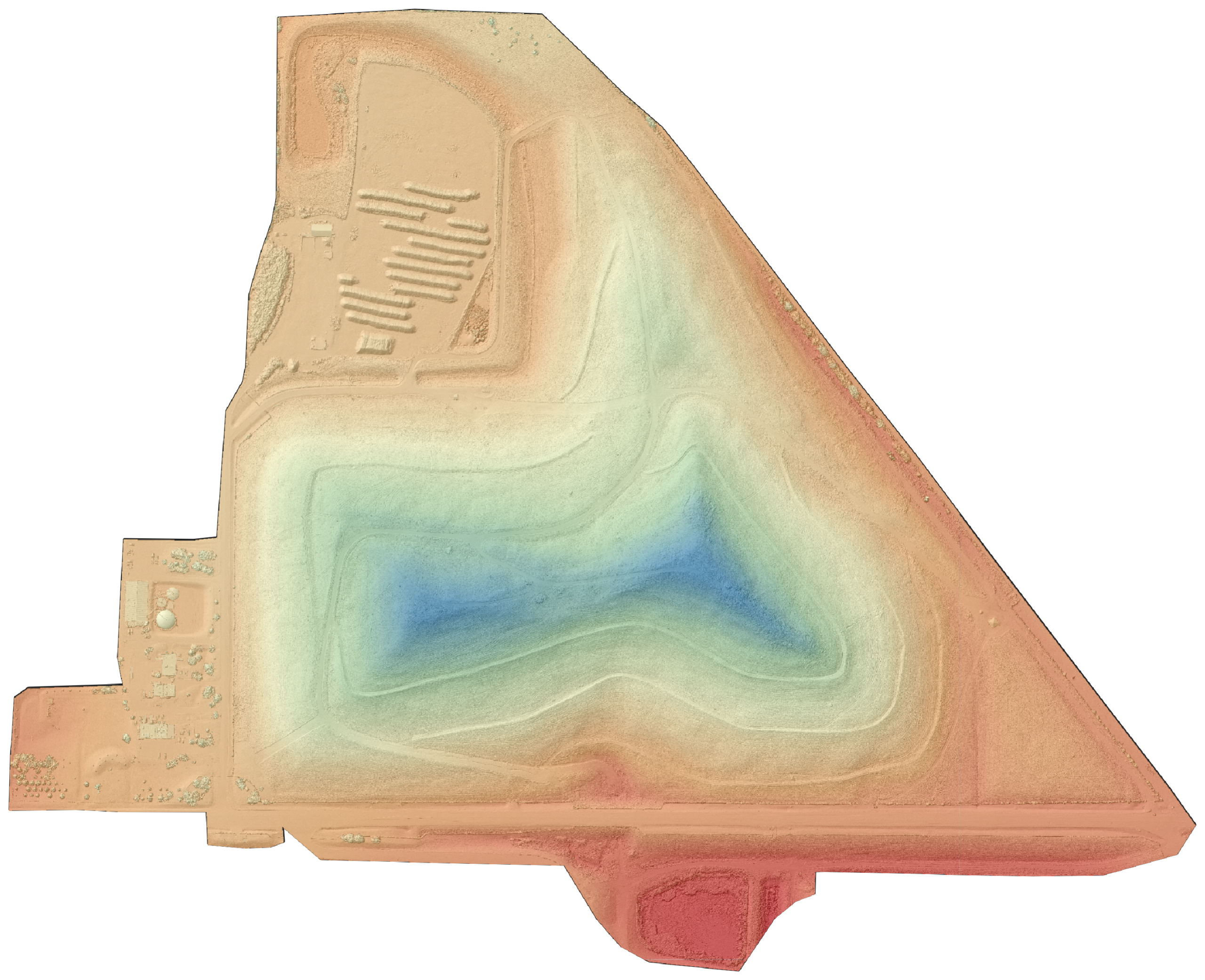
Digital elevation models reveal site topography, grading conditions, and elevation changes not visible in standard photography
03
Analyze Drainage And Grade
Generate contour maps and slope visualizations useful for drainage, earthwork, planning, and site evaluation
04
Explore The Site Online
Allow stakeholders to zoom, inspect, and review project information through a browser-based mapping interface
05
Inspection Documentation
High-resolution imagery supporting facility assessments, infrastructure documentation, and condition reporting
06
Large-Area Coverage
Document dozens or hundreds of acres within a single coordinated mapping project

COMMERCIAL PROPERTY DOCUMENTATION

Property Documentation You Can Measure

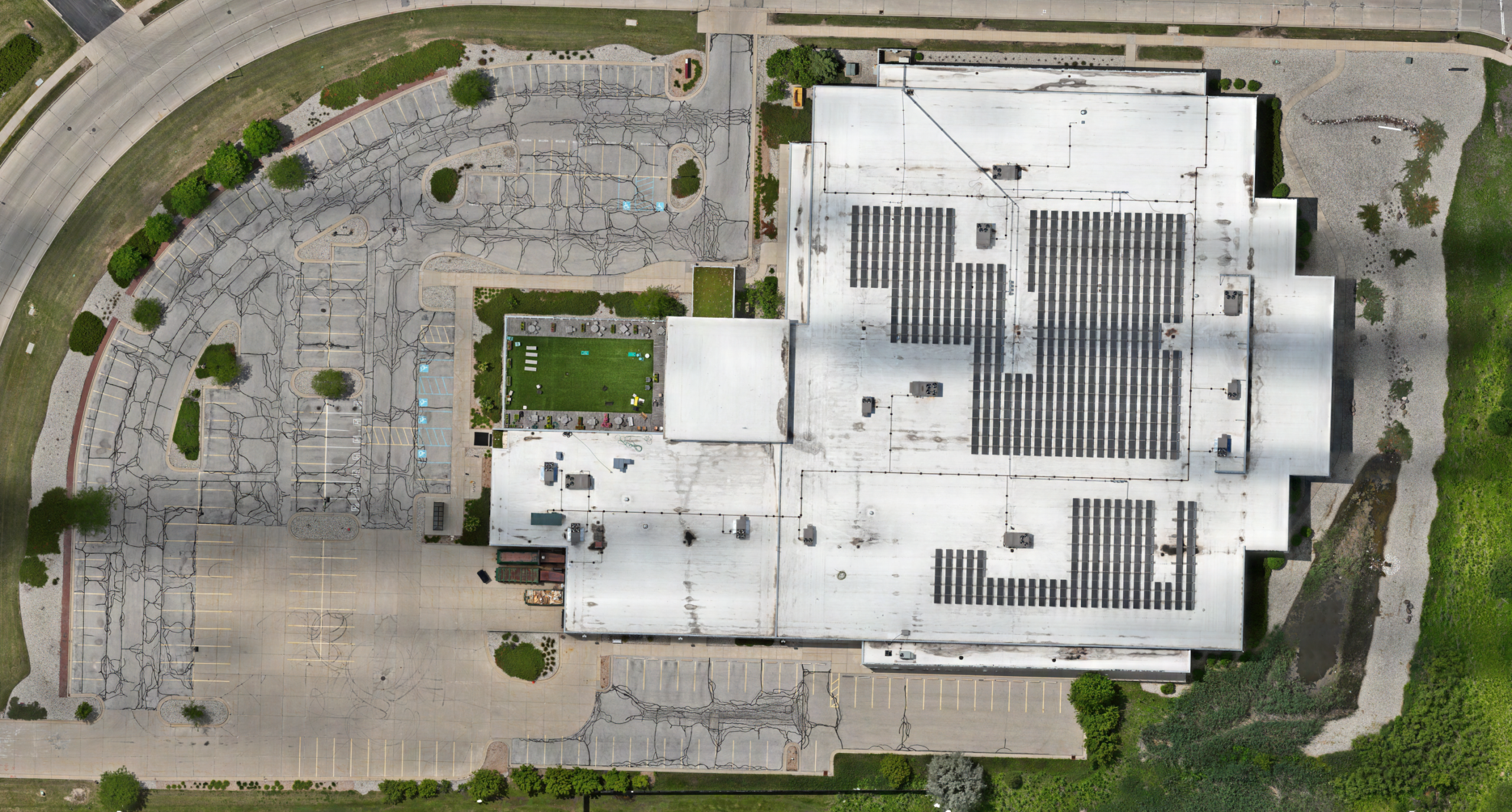
Explore a measurable orthomosaic documenting rooftop solar arrays, pavement conditions, parking facilities, drainage features, and surrounding site infrastructure – all captured during a single aerial survey. Every feature visible in this image – including rooftops, pavement, parking, drainage, and equipment areas – can be measured directly within the interactive viewer.

PROFESSIONAL DELIVERABLES

Mapping Deliverables Beyond Conventional Aerial Photography

Professional drone operations can produce both high-resolution imagery and advanced mapping deliverables. Depending on project requirements, deliverables may range from inspection photography and visual documentation to orthomosaics, terrain models, contour products, and interactive mapping viewers.

Measurable orthomosaics

Terrain & elevation products

Contour generation

Slope analysis

Interactive mapping viewers

Large-area project coverage

GIS-compatible outputs

REDEVELOPMENT PROJECTS

Document Large Sites With Measurable Aerial Mapping

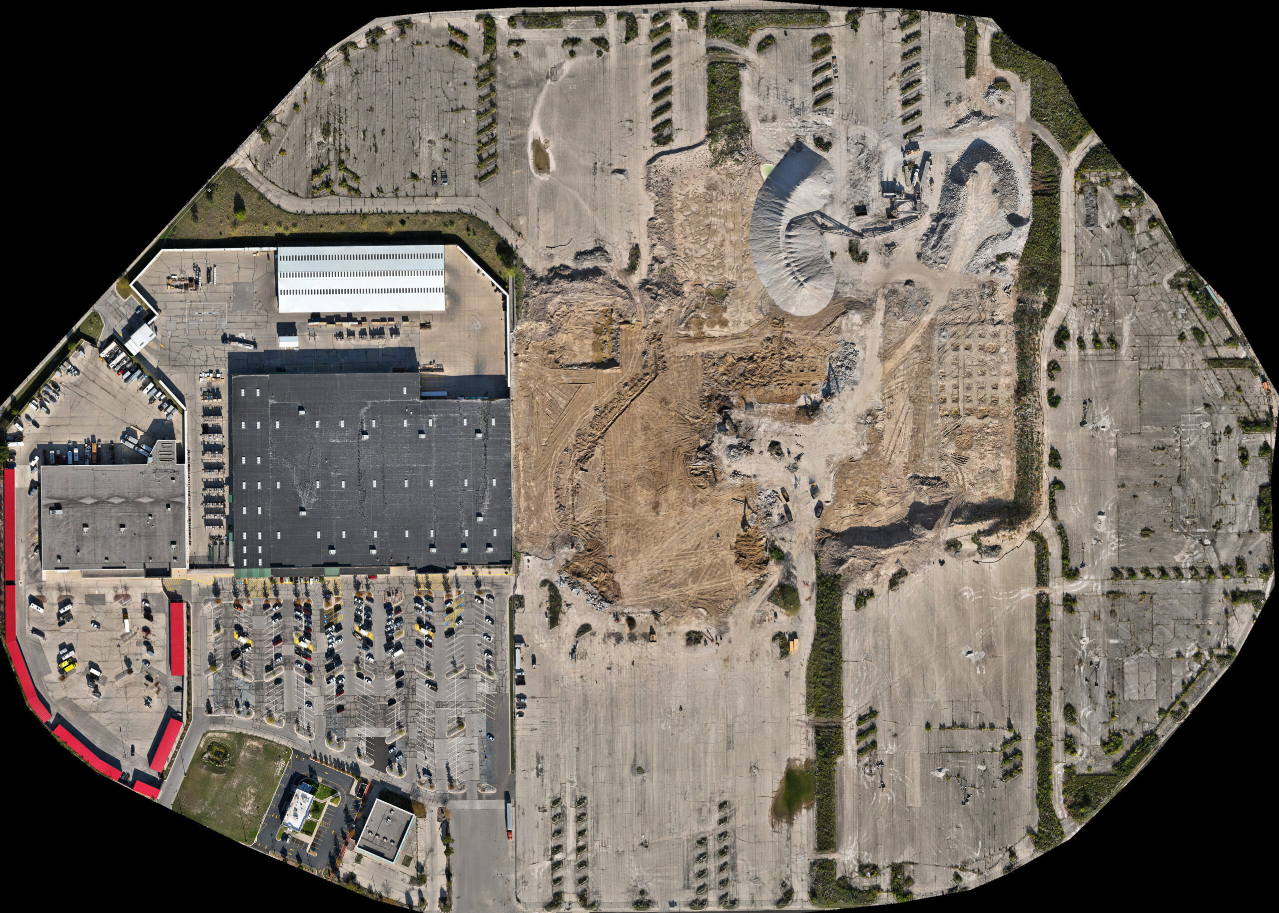
Track demolition, grading, material stockpiles, pavement removal, and site progress using orthomosaics designed for measurement, analysis, and repeatable documentation. Repeat flights over the same property provide measurable documentation of demolition, grading, paving, and construction progress.

PROJECT INSIGHTS

What Can A Mapping Project Help You Understand?

Every property presents different questions. Aerial mapping provides current, measurable documentation that helps property owners, engineers, and project teams understand existing conditions, evaluate assets, monitor change, and support informed decisions throughout the life of a project.

01
Existing Site Conditions
Document current property conditions before renovation, construction, ownership transfer, maintenance work, or long-term asset planning.
02
Roof & Facility Assets
Review rooftops, equipment areas, loading zones, access drives, parking areas, drainage features, and surrounding site infrastructure.
03
Pavement & Drainage
Identify pavement conditions, drainage patterns, ponding areas, surface changes, and site features across large commercial properties.
04
Project Progress
Repeat surveys throughout demolition, grading, construction, redevelopment, or site improvement work to document measurable change over time.
06
Historical Documentation
Create a permanent visual record of site conditions that can be referenced months or years after work has been completed.

PROJECT PROGRESS DOCUMENTATION

See A Project Evolve Over Time
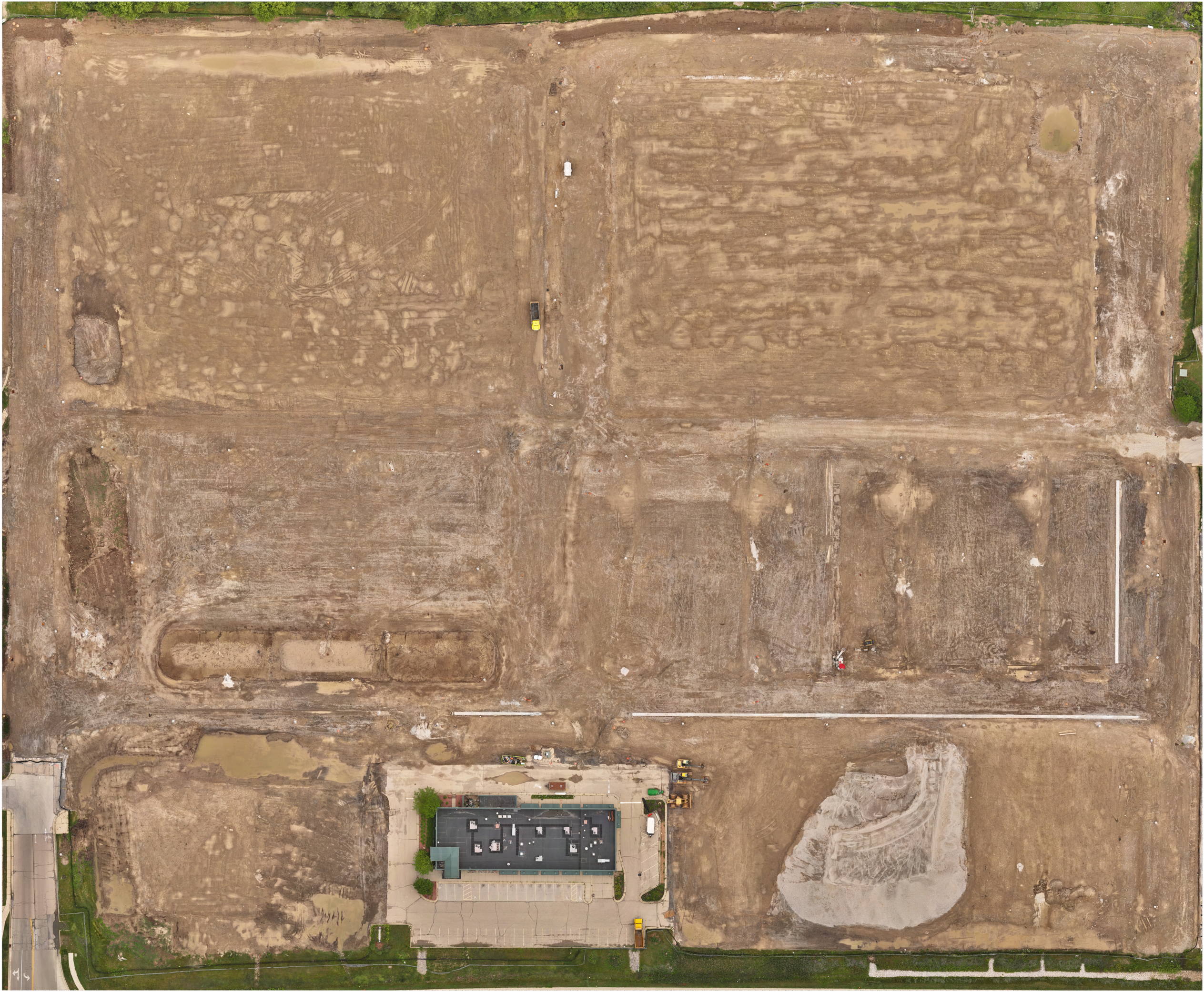
Capture identical aerial surveys throughout a project’s life to document measurable change over time.

Target redevelopment progress capture 0

Construction progress documented through July 14, 2026

COMMON APPLICATIONS

Typical Project Environments

Construction sites, redevelopment projects, commercial properties, industrial facilities, solar installations, and landfills each present unique documentation, inspection, and mapping requirements. The examples below illustrate common project environments where aerial data collection and measurement-capable deliverables provide value.

01
Commercial Properties
Existing-condition documentation for commercial buildings, parking facilities, rooftops, drainage features, access drives, and surrounding site improvements.
02
Industrial Facilities
Document manufacturing plants, warehouses, equipment yards, utility corridors, storage areas, rail access, and facility infrastructure.
03
Construction & Redevelopment
Capture existing conditions, demolition, grading, paving, construction progress, and completed improvements through repeatable aerial documentation.
04
Solar & Energy Facilities
Document rooftop and ground-mounted solar installations, equipment layouts, drainage conditions, completed work, and facility development.
05
Large-Area Sites
Efficiently document landfills, industrial campuses, utility properties, and other large sites requiring consistent, measurement-capable coverage.
06
Infrastructure & Site Improvements
Record pavement, drainage systems, access roads, utilities, retaining structures, and other site improvements for planning and long-term documentation.

ONE SURVEY • MULTIPLE DELIVERABLES

One Survey - Multiple Mapping Products

Every deliverable shown below was generated from a single aerial survey – providing imagery, terrain visualization, elevation analysis, and topographic mapping from one data collection.

Color-relief elevation model of the landfill terrain

Color-relief elevation model generated from RTK drone photogrammetry.

DISCUSS YOUR PROJECT

Let’s Discuss Your Project

Let’s discuss your project objectives, site conditions, and the mapping, inspection, or documentation deliverables needed to support your project.

Contact Form

Aeroscope Drone Services

Scroll to Top